University of Minnesota Duluth block M and wordmark

  A    B    C    D    E    F    G    H    I    J    K    L    M    N    O    P    Q    R    S    T    U    V    W    X    Y    Z
~ Google advanced
 
~ Google scholar
 
~ Google books
 
~ Google images
 
~ Google Translate
 
~ Google URL Shortener
 
~ Blenco Search
 
Wikipedia
 
Wiktionary
 
The World Fact Book -- CIA
 
UMD Library Main Catalog


Anthropology in the News

Canvas
TR HomePage
TR Courses

Ancient Middle America

Spring 2019 Calendar

Wikipedia
 map: topographic
  map: Mesoamerica and Its Cultural Areas
  Mesoamerica
 Pre-Hispanic Mesoamerica

OWL logo, Online Writing Lab, Purdue University.
class slides on-line
(free PowerPoint Viewer 2010)


Ancient Middle America Course Information


Search the troufs Site
(all TR courses and web pages)
 

Tuesday, 19-Mar-2024 11:21:49 GMT

to top of page / A/Z index   to top of page / A-Z index


Ancient Mexico Map Thumbnail
Ancient Mexico Map
Living Stones
Where Archaeology Begins
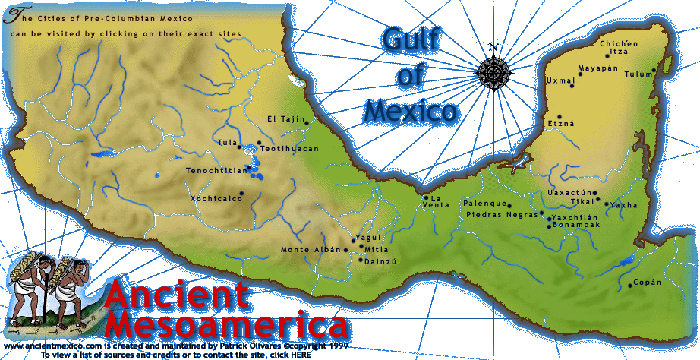
Chichén Itzá:
At the Mouth of the Well
(27 min., 2002, DVD 108)

The Observatory, Chichen Itza

The Observatory
(Edward Dawson)

Wikipedia:
Chichén Itzá
Sacred Cenote at Chichén Itzá

search "Chichén Itzá" on JSTOR

to top of page / A/Z index   to top of page / A-Z index

Chichén Itzá HomePage

Map of Major Mayan Archaeological Sites

Map of the Mayan World -- NOVA

Other Maya Sites

Abstract Terms / Concepts Notes
Cultures Sites Individuals Bibliography /
Resources

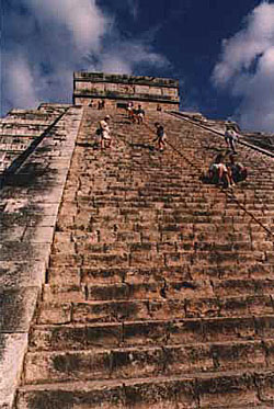
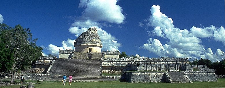
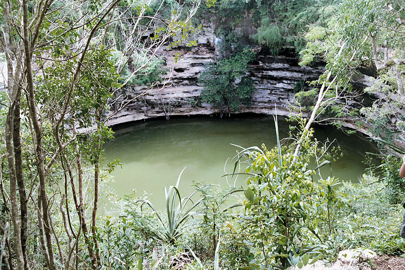
"The fusion of Mayan construction techniques with later elements from central Mexico makes Chichén Itzá one of the most important examples of the Mayan-Toltec civilization in Yucatán. In this program, archaeological footage and computer re-creations spotlight prominent locations in the city, including the imposing Pyramid of Kukulcán, the Temple of the Warriors, the circular observatory known as El Caracol, the largest ball court in Mesoamerica, and the Well of Sacrifice—a sacred water-filled cenote into which votive offerings and human sacrifices were cast."

to top of page / A/Z index   to top of page / A-Z index

Terms / Concepts

  • Maya-Toltec

  • cenote -- a natural water hole in the Yucatán penninsula formed by the collapse of the limestone crust, thereby exposing subterranean water

  • chichén = "well"

  • chultun -- underground cistern used for water storage in northern Yucatán

  • chac mool -- figure lying on its back with flexed legs, holding a flat dish on its stomach

  • sacbé -- causeway or road

  • Nahua -- Aztecs

  • tzompantli -- skull rack

  • Fifth world: 13 August 3114 - 23 December 2012

  • Books of Chilam Balam -- postcontact manuscipts, written in european script by Yucatecan Maya

Notes

  • "Plaza of 1000 Columns" ajoins the "Warrior Temple"

  • El Castillo

    • dedicated to Quetzalcoatl, who was known to the Maya as Kulkulcán


Cultures

  • Toltecs

    • capital = Tula, Hidalgo

  • Itzá

  • sometime around A.D. 928 - 948 they "Burst into Maya country"

Sites / Locations

  • Chichén Itzá

    • divided into two areas

      • Southern area = Puuc Hills style

      • Northern area= Mexican Style

  • Tula, Hidalgo

  • Uxmal

    • ancient capital of Yucatán


Sacred Cenote at Chichen Itza.

Sacred Cenote at Chichén Itzá
Wikipedia

© 1998 - 2023 Timothy G. Roufs — All rights reserved     Envelope: E-mail
Page URL: http:// www.d.umn.edu /cla/faculty/troufs/anth3618/video/Chichen_Itza.html
Last Modified Tuesday, 07-Dec-2010 10:53:05 CST
Site Information / Disclaimers ~ Main A-Z Index


View Stats