Prev
Next
Locale: Utah - Uinta Mountains
King named the lake after a friend of his sister. The lake is probably the one now known as Lake Ryder in the Middle Basin on the north side of the Mt. Agassiz (the leftmost peak).
The plate closely matches painting #37. QFD Pl.16. Tweed 2003 Exhibition n.39. In the collection of the Great Plains Art Museum, Univ. of Nebraska, Lincoln. Image is a direct scan of the Systematic Geology plate.
Prev Next
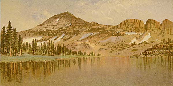
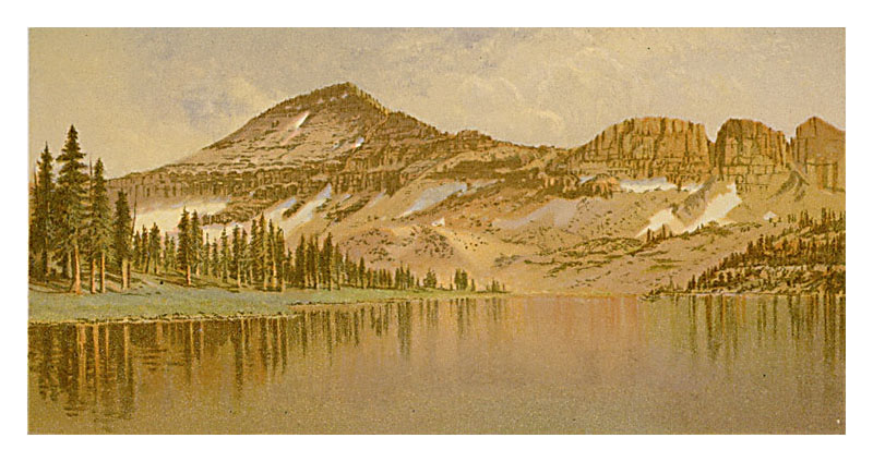
#148. Lake Lal(l) and Mt. Agassiz - Uinta Range - Utah.
4.5 x 8.5, chromolithograph. Title on plate. This chromolithograph is Plate VIII in Clarence King's Systematic Geology, published in 1878 as part of the record of the United States Geological Exploration of the 40th Parallel, 1867-1872. The plate is one of ten based on sketches by Gilbert Munger, who was a guest artist of the survey. Munger was in this area with the King survey in the fall of 1869. See this site page for more complete information.King named the lake after a friend of his sister. The lake is probably the one now known as Lake Ryder in the Middle Basin on the north side of the Mt. Agassiz (the leftmost peak).
The plate closely matches painting #37. QFD Pl.16. Tweed 2003 Exhibition n.39. In the collection of the Great Plains Art Museum, Univ. of Nebraska, Lincoln. Image is a direct scan of the Systematic Geology plate.
Prev Next
© Michael D. Schroeder 1 Sep 1999; Updated 20 May 2019.