Prev
Next
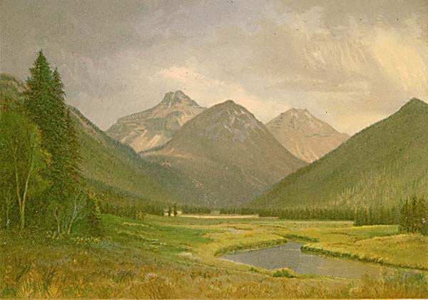
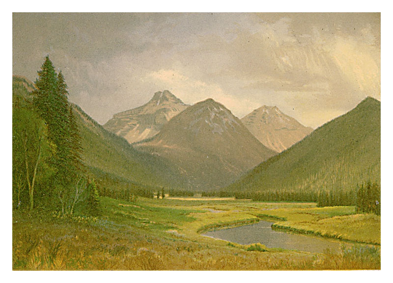
Locale: Utah - Uinta Mountains
Munger was in this area with King in 1869. The tallest peak is Mt. Agassiz viewed from the north.
Tweed 2003 Exhibition n.38. Image is a direct scan of the Systematic Geology plate.
Prev Next
#147. Upper Valley of the Bear River - Uinta Range - Utah.
6 x 8.5, chromolithograph. Title on plate. This chromolithograph is Plate VII in Clarence King's Systematic Geology, published in 1878 as part of the record of the US Government's Geological Survey of the 40th Parallel, 1867-1872. The plate is one of ten based on sketches by Munger, who was a guest artist of the survey. See this site page for more complete information.Munger was in this area with King in 1869. The tallest peak is Mt. Agassiz viewed from the north.
Tweed 2003 Exhibition n.38. Image is a direct scan of the Systematic Geology plate.
Prev Next
© Michael D. Schroeder 1 Sep 1999; Updated 20 May 2019.