Even if you've never heard of Prudhoe Bay, most people have heard of the Trans-Alaska Pipeline--which is truly an engineering marvel. Since the Arctic Ocean at Prudhoe Bay is ice-free for only six weeks out of the year, the pipeline was built to move North Slope oil from Pump Station No. 1 at Prudhoe Bay to an ice-free port terminal at Valdez, Alaska, 800 miles to the south.The pipeline is four feet in diameter, and built in most places about 5 feet above ground to allow passage of wildlife underneath. The line is also constructed in a zigzag pattern to allow for not only thermal expansion, but also to allow non-destructive movement during one of Alaska's frequent earthquakes. Fortunately, strong earthquakes are fairly rare, but the pipeline is designed to allow 5 feet of vertical movement and up to 20 feet laterally just in case.
The oil is helped along the line by a series of pump stations located, on the average, about 75 miles apart. Since the pump stations are often located in remote areas far from power supplies, some of them just tap energy from the pipeline itself! They have a small on-site refinery to make jet fuel. The jet fuel is used to power a stationary jet engine, which drives the pumps and acts as the station's power plant. However, the addition of friction-reducing agents to the oil, together with reduced field production, have resulted in the mothballing of several of the pump stations.
The oil takes about 5-1/2 days to make the trip all the way down the pipeline. When it reaches Valdez, it is loaded onto supertankers for transport to either West Coast refineries, or since 1998, for possible export to Asian markets.
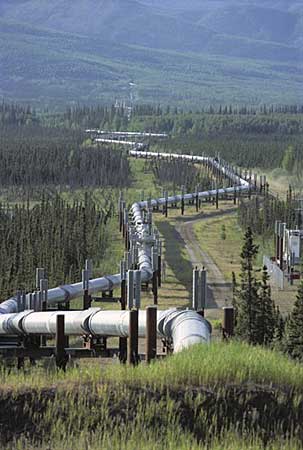
The Trans-Alaska Pipeline zigzags through the wilderness.
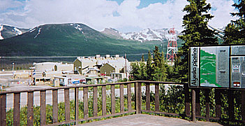
Pump Station 12 along the Richardson Highway north of Valdez.